Showing posts with label New York. Show all posts

Monday, July 4, 2011

Sunday July 3: Hamlin Beach

Today was my final day in the Rochester area. John and I decided to go to Hamlin Beach State Park. It was a place we went in the summer (usually) all the time growing up (each with our families) but hadn't been to since a few years after we graduated high school.

John knew the route to the park and we had no trouble getting there. The entry fee was $7 (oh, the horror). There were plenty of people there mostly in the central area, probably because that was where the snack bar was. There were lots of families using the grills.

The fact that there were buildings was a surprise. I'm not sure whether they weren't there before or I had just forgotten. There certainly seemed to be more than before. The beaches seemed to be clean (i.e. no dead fish as I recalled) but I wasn't sure about the water. It was cloudy but I wasn't sure what that meant. The beach was broken up by a series of jetties of jumbled large rocks, probably to break up any currents running parallel to the beach. There were also lifeguard stations at each beach section, although not all were manned. I think the jetties were there before but not the lifeguards. It seems a lot of effort had been put into the beach since were had been there last.

The same couldn't be said for the parking areas. Although there weren't any deep ruts that I remember there was grass growing out of expansion cracks all over the place. Seagulls had picked out certain sections of some of the lots to rest in (that hadn't changed). We had fun driving through them although we had to go slowly because they didn't really want to move (we didn't hit any).

After getting drinks at the snack bar we walked out on one of the jetties to try to look at the bluffs at the west end of the beach. Unfortunately, all we saw were trees. So we decided to go to the source. We drove over to the last parking area and walked to the west edge of the beach.

When we got there, all we saw were trees. We walked up to the signs saying don't go past this point but didn't go in. There was a path past the signs but the greenery was dense enough we couldn't see too far past the edge of the trees. I took a few pictures and we left. Thinking about it later it occurred to me that the trees may have been part of the stabilization of the bluffs. Although I remember a few trees the last time I was there (about 1979) and some plants on the ground, I think mostly the bluffs were just sand.

Wednesday, June 29, 2011

June 29, 2011 Brockport, NY

Today I only had a few things planned. I was going to start off with a lunch with John H. I hadn't seen him since the reunion and had no idea what he has been doing. We met at a local eatery. I told him about what I had been doing and he told me what he was up to. He has a wife and three kids has a job and is a peace activist.

After lunch I met up with John (a different John, my host) and his phone with GPS at the start of the path to the Soldiers' Memorial. I made another video of the walk along the path toward the monument. After I had that done, I took a few pictures and then we went geocaching. We used John's GPS and the coordinates I had on the cache to try to find it. The place where I had looked before was completely wrong. The cache was much further off the path than I was expecting. But the coordinate resolution of the phone was precise enough that we found the area where the cache was hidden. Then it was just a matter of looking around. John actually found it. I took a rock that had been labelled with "Brockport, NY" and some initials to take down to Dallas and dump in a cache there.


After that John went back home to do work and I headed into Brockport to get video of the liftbridge. I wanted to get the full cycle from the traffic lights turning red, the bridge raising and lowering to the traffic light turning green again. I got all of that but the sound was corrupted a bit by the wind.


As I was packing up to leave I realized I hadn't taken out Mike's pants at all - for the bridge or the tower. So I went back to the car and got it and took a few pictures of it on the bridge. Then I drove back to the monument and trekked in for the fourth time to get some pictures there.

That was all of the adventuring for the day. Back "home" we had pizza and then went out for ice cream.


June 28, 2011 Rochester, NY

Today I decided to go into Rochester to look at various museums and such. Unfortunately, the Memorial Art Gallery was closed today. Also, the Strasenburgh would be closed except for shows, which I think happened in the evening on weekdays.

However, the science & history museum of the RMSC was open so I took a tour around. Several of the sections were particularly tuned to kids - lots of trying different things and such. There was a big section on the first floor about how glaciers effected the topology and life that happened in the Rochester area throughout history. There was a nice skeleton of a Wooly Mammoth (I think).

Elsewhere, in a diorama, there was a crab-like animal that I remember seeing even the first time. I think it's in a new setting and has been cleaned up since it looks pretty new.

Also, there was a little blurb about the first digital camera which was made in Rochester in 1974.

There was a section on the underground railroad and how it effected Rochester and other places, but I didn't spend much time in the exhibit.

Outside I saw a statue of a stallion painted blue with gold stars. I don't know if this was part of an arts program in Rochester or something else.

Finally, reading a sign showing the different building in the RMSC, I noticed that the planetarium has added a Challenger Learning Center. It wasn't open but I got a picture of the entrance.


Next, I went to the Eastman House. I had some difficulty finding it due to lack of visible street numbers. I got to the parking lot and eventually got into the house (there was a guided tour that blocked my way for a bit). I was able to see several rooms of the house including the conservatory which had, among other things, a giant elephant head mounted on the wall. This was from a real elephant killed on one of his safaris (very common for rich people of his era).

There was also an exhibition of Norman Rockwell showing the photographic studies that he did to prepare a painting. I saw paintings that I was familiar with and many others that I was not. Each with at least some of the photos used to help create the painting. I wasn't allowed to take pictures so I can't show anything from that exhibit.

I wasn't feeling that well so I decided to leave for my next destination rather than explore the gardens which I would have liked.


Next I went further down East Ave. to find a photo place where I might get a tripod. After experimenting with their compact one I decided to get it.

Then I had an adventure getting to the northeast of the city. I had a map and got some directions but I stopped at least once to check where I was and did make one wrong turn. After finding the shop I was after I headed back on Ridge Road. I stopped to get lunch and some throat candies and headed back to Spencerport. As I was driving along I noticed that there was another store from the same company in Greece (west of Rochester) as I had traveled a bit of a distance to find east of Rochester. Oh well.

June 27, 2011 Brockport, NY

This day I started out in search of the Soldiers' Monument. I took along my camcorder and camera (John gave me an "Indiana Jones" satchel to carry everything.

First I took some pictures and recorded video of the sign. Traffic was pretty heavy on Owens Road, so my comments were sometimes rumbled and whooshed over. After I got done with that I repositioned the car (other side of the road, further off the road) and took everything down the path that was visible from the road - although the monument wasn't.

Although I got a complete recording of the trek (with commentary), the camera was often looking up to the side rather than ahead so often I was commenting on something the viewer couldn't see. There was a row of trees about 50 feet from the road that seemed to cut off the path. However, the path jogged to the left, which you couldn't see from the road because another tree blocks the view. After a few more yards I could see the tower straight ahead.

Next along the path was a line of brambles which cut across the path; however, someone had cut them back so they were out of the path. The path became very clear after the brambles, although the grass was waist high.

Along the way I spotted the two grave sites that remain from the cemetery that the tower was originally supposed to watch over. There was a small flag that had probably been put during Memorial Day which was just a few weeks ago. The names are visible on both headstones but some of the other writing is unclear. I noticed that the photos had a slightly different color balance than my eyes so different words were visible in the picture than I could originally see. I wonder if fiddling with the photos in Photoshop would help?

After I was done remarking on the graves I went back to the patch and came over a small rise. At that moment I saw a deer and her baby eating on the path. The didn't notice me so I was able to get some video of them just grazing. There were some focus issues so I couldn't get closeup video. Also, I kept walking instead of standing still so the images are annoyingly shaky. Anyway, I made a noise which got the baby's attention, who alerted mom and they both scampered into the trees.

The tower was much as I remembered it. The top was missing some chunks. Most of the rest of the tower looked fine except that a lot of stones to the left of the archway. The plaque was clearly readable. There seemed to be a metal pole leaning to one side in the tower. It's my understanding that this is what's left of the spiral staircase. I have photos and video of the view up the tower from inside with the outside light creating a glow at the top. There are warnings somewhere not to come near the tower because of falling stones, but I've never seen stones fall and almost everyone has poked their head in.

At this point, something stupid happened - or at least I thought it had happened. I thought that I hadn't had the camera recording during the walk up because I misread the status buttons. So I changed how I was recording to resolve the issue. I headed back, taking some pictures of the graves and repeating commentary. I then went back to the beginning of the trail and tried to record commentary again. It turns out the first take had been recorded correctly. The second take was not recorded because I didn't interpret the status buttons correctly.

After I was done with the video recording, I tried to complete the final task at the site. There is supposed to be a geocache somewhere near the tower. An encrypted hint suggested that it was under a bunch of logs. I didn't have a GPS device so I didn't know where the listed coordinates actually put me. I just walked along the path back to the road and occasionally stepped off the path to look for logs. I did find one pile and tried to look in all of the crevices that were visible, but I didn't disturb the logs that much. I finally gave up and took a few pictures.


My next goal was to go into Brockport and look around. Unfortunately there is major construction along Main Street that I couldn't get into town from East Avenue. I had to go up Park and across the lift-bridge. I parked behind the bank and looked around. There was construction everywhere - even in the parking lot. Next to the old Strand Theater a building had collapsed (I though it had been deliberately torn down but John's House-cleaner said it fell down); they were digging up the street right by Liftbridge Books (which had moved); half of Main Street north of State St. was blocked off and being repaved. I found out later the whole street was blocked off near Morgan-Manning.
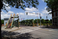


I walked around for a bit and took pictures of the construction and the liftbridge. Then I had lunch. After walking by the canal I came back to Main St. and noticed a boat sitting in the center of the canal. I was taking pictures of the bridge control tower when I saw someone drive up with a state logo on the car and figured she was going to raise the bridge. So I raced back to the Main St. side of the bridge and go in position to witness the bridge raising and lowering. I was able to snap pictures of pretty much every state of the raising/lowering. The flash popped up several times and I have pictures of varying color depending on whether the flash emitted or not.
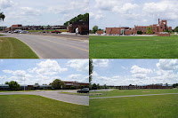

After that I packed up and went to school. Specifically I went town to Brockport Central School and had a look around. I took a few pictures. One of them showed work that was going on now. From my memory I recall a building where the school busses were parked that appears to be gone. I also found a sign that showed when the various parcels of land went to the village for the school. I got a few pictures of the new school too.

I drove through SUNY Brockport but didn't stop.

From there I headed back to my friends house. I stopped at the Spencerport Tops to get a few things that I had forgotten before.